

Catalina State Park
Romero Ruins and Canyon Loop at Catalina State Park
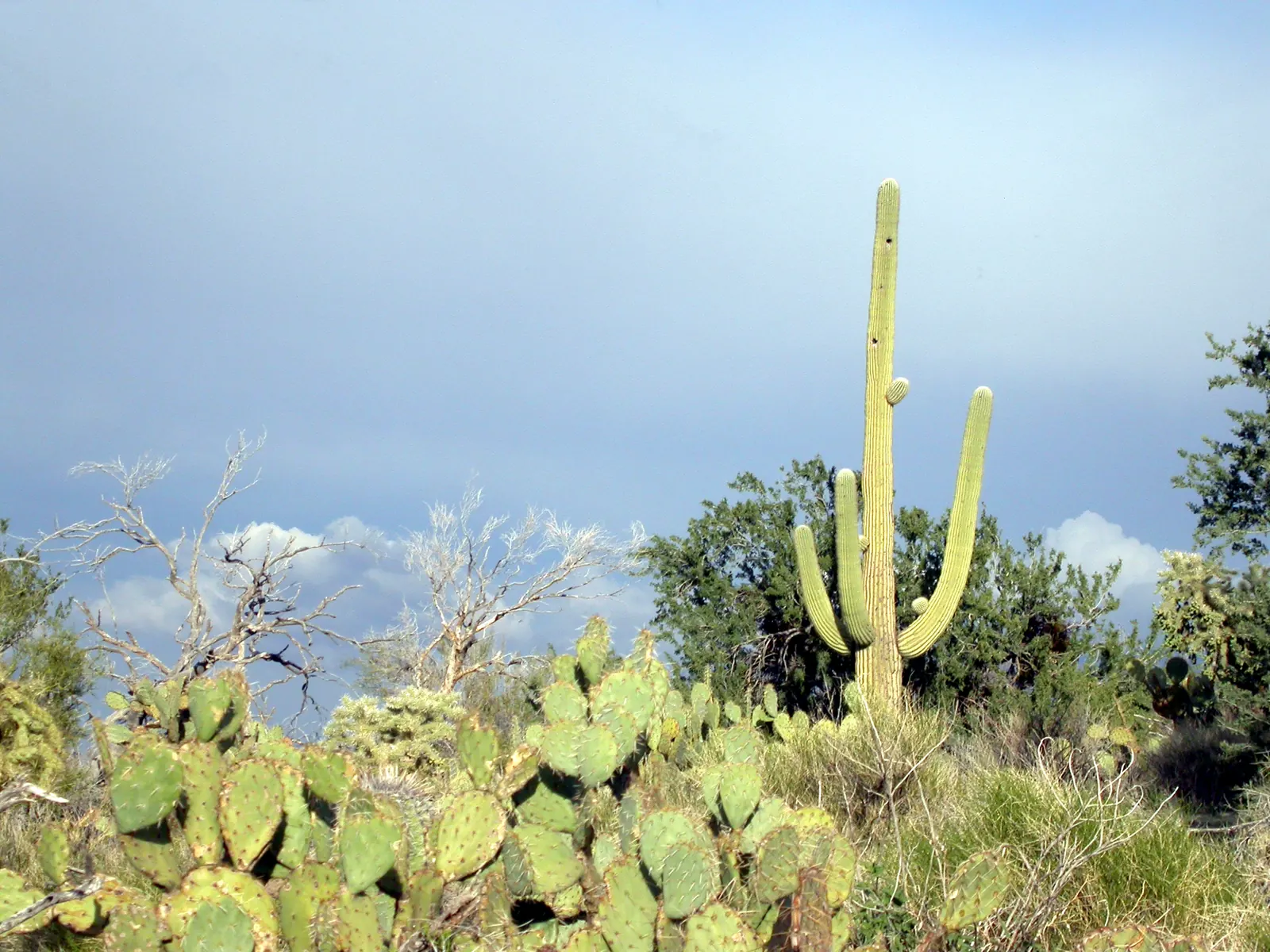
A short ruins loop and a 2.3 mile canyon loop in Catalina State Park, with wash crossings that can run after rain.
Area page: Santa Catalina hikes.
What are the hours at Romero Ruins and Canyon Loop?
Romero Ruins and Canyon Loop opens at 5AM and closes at 10PM. The visitor center is open 8AM to 5PM daily, and summer hours may vary.
Access
- Rules
The 2026 park map use table marks the Romero Ruin Interpretive Loop DH, so dogs and hikers are allowed and horses and bicycles are not. Dogs must be on a leash no longer than 6 feet, and you pick up after them. The Canyon Loop Connector is BDEH, so mountain bikes, dogs, horses, and hikers may use that link. Horses have the right of way. People walking uphill have the right of way. Electric bicycles and other motorized vehicles stay on park roads. Stay on designated trails. Do not dig or collect artifacts.
- Parking
The main trailhead is 1.5 miles north of the ranger station, at the end of the entry road. The Romero Ruins ramada lot is 0.8 miles north of the ranger station, on the west side of the road. Park only in designated parking areas, not on the side of the road. The park address is 11570 N. Oracle Rd., Tucson, AZ 85737.
- Fees
Day use is $10 per vehicle with 1 person, $20 per vehicle with 2 to 4 people, and $5 for a person walking or on a bicycle. A self-pay station is available for entrance after hours. It takes cash only, in the exact amount.
Catalina State Park trails. 2026 park map. Turn around, don't drown.
Flood alerts for Pima County
These are the same Pima County flood alerts as Tucson flooding today. A quiet list is not a reason to cross a wash.
No flood alerts are in effect for Pima County as of Nov 12, 1:18pm MST. A quiet list can change quickly. Look again at weather.gov/twc before you cross a wash.
Lower heat exposure through 5pm (81F forecast at 3pm). Forecast hours start at 1pm. Sunset about 5:25pm. Forecast issued at 11:32am MST.
Check conditions before you go.
Today
Today, hour by hour. Sunset is about 5:25pm, and later hours aren't rated.
Tomorrow morning
Tomorrow from 5am to noon, if the forecast goes that far.
Photos
NWS alerts
No weather alerts for this trail as of the last update.
NWS HeatRisk, experimental
Level 1 (Minor) for 2026-11-12. HeatRisk is an experimental NWS product. For official heat warnings, go by NWS watches, warnings, and advisories.
Creek flow downstream
USGS 09486350 measures Cañada del Oro below Ina Road, near Tucson. It is miles downstream of the park, not a gauge on these trails. Water in the park washes can differ from this gauge.
Downstream creek gauge (Cañada del Oro below Ina Road)
Discharge 0.00 cfs at 12:30pm MST (Provisional).
Gage height 4.11 ft at 12:30pm MST.
Cañada del Oro below Ina Road, miles downstream of the park: dry. Washes in the park can still run when this gauge reads low or zero.
Gage height is the mark on this gauge, not the depth you would step into.
Provisional USGS data can be revised. USGS page.
USGS 09486350. Sabino Creek, Tanque Verde Creek, and this downstream gauge are on Sabino and Tanque Verde creek flow.
Trail facts
Trailhead location
Catalina State Park main trailhead. 32.42564, -110.90815. The forecast pin is the main trailhead GPS on the trails page. The Canyon Loop starts there. The Romero Ruins ramada is a short way west, in the same forecast square. Source: Catalina State Park trails.
Elevation
2,717 ft. From USGS elevation data for the map pin.
Forecast area elevation
2,795 ft for the NWS forecast area near Oro Valley, AZ. The NWS forecasts for squares about 2.5 km (1.5 miles) across, so it can be hotter or cooler on the trail itself. Forecast updated 11:32am MST.
Canyon Loop
The trails page calls the Canyon Loop moderate, 2.3 miles, and a loop from the main trailhead. It is the Romero Canyon Trail, the Sutherland Trail, and the Canyon Loop Connector, with signs that say Canyon Loop. The 2026 park map says the same 2.3 miles: it starts at the park trailhead on the Romero Canyon Trail and follows a crosscut to the Sutherland Trail. The desert hikes page says to plan on 90 minutes. It calls the loop relatively flat, with about 90 stairs halfway around and a bypass for horses. Source: Catalina State Park trails.
Romero Ruins loop
The trails page calls the Romero Ruins Interpretive Trail easy, 0.8 miles, and a loop from the Romero Ruins ramada parking lot. It walks through a Hohokam village site the park dates to around 500 AD, and past the foundation of the late 1800s Romero homestead. Trailside signs tell that story. Do not dig or collect artifacts. The 2026 park map text also lists this loop at 0.8 miles. Source: Catalina State Park trails.
Ruins loop length
The 2026 park map text and the trails page both list the Romero Ruins Interpretive Trail at 0.8 miles. The 2026 trail map drawing lists that loop at 0.75 miles. Source: Catalina State Park 2026 trail map.
Where to start
The main trailhead is 1.5 miles north of the ranger station, at the end of the entry road. Its GPS on the trails page is 32.425644, -110.908155. The Romero Ruins ramada lot is 0.8 miles north of the ranger station, on the west side of the road. Its GPS is 32.423322, -110.919086. The main trailhead listing includes restrooms and water spigots. The ruins lot listing includes a shaded ramada, picnic tables, and grills, and it does not list water. Source: Catalina State Park trails.
Washes
The Canyon Loop crosses washes, then a desert riparian stretch under tall sycamore and ash when the creeks are flowing. The trails page says winter rains from December through March and summer monsoon rains from June through September can put water across both this loop and the ruins loop. The 2026 park map says the Canyon Loop crosses a wash with seasonal streamflow, and it says thunderheads can signal a flash flood even when it is not raining where you stand. If water is running, turn around. Source: Catalina State Park trails.
Trailhead elevation
The main trailhead sits at about 2,717 feet. The Romero Ruins ramada lot sits at about 2,693 feet. Those are the parking spots, from USGS elevation data, not a high point on the loops. Neither park page lists elevation gain for these two loops. Source: USGS 3DEP elevation point service.
Forecast square
The National Weather Service point for 32.4256, -110.9082 is grid TWC 94,58, near Oro Valley, in forecast zone AZZ504. The ruins lot falls in that same square. Source: NWS points API.
Dogs, horses, and bikes
The 2026 park map use table marks the Romero Ruin Interpretive Loop DH. D means dogs and H means hikers, so dogs are allowed and horses and bicycles are not. The Canyon Loop Connector is BDEH: mountain bikes, dogs, horses, and hikers. Dogs on park trails stay on a leash no longer than 6 feet. The desert hikes page describes a horse bypass around the stairs on the Canyon Loop. Source: Catalina State Park 2026 map.
Fees
Day use is $10 per vehicle with 1 person, $20 per vehicle with 2 to 4 people, and $5 for a person walking or on a bicycle. A self-pay station is available for entrance after hours. It takes cash only, in the exact amount. Source: Catalina State Park.
Water
The main trailhead listing includes water spigots. The ruins lot listing does not. The 2026 park map says to take plenty of water, and that when your water is halfway gone, the hike is halfway over. Do not count on the washes for drinking water. Source: Catalina State Park 2026 map.
Sun and shade
The trails page describes open grasslands and, farther along the Canyon Loop, shade under tall sycamore and ash. It does not give hour-by-hour shade. The park map says to wear a hat. Source: Catalina State Park trails.
Official links
- Catalina State Park
- Catalina State Park trails
- 2026 park map
- 2026 trail map
- Desert hikes
- NWS forecast point
- USGS 09486350, downstream
- Romero Canyon, a longer hike
Nearby trails
- Romero Canyon (1.8 miles away)
- Pima Canyon (5.5 miles away)
- Finger Rock Trail (6.1 miles away)
See also the heat guide, the monsoon guide, and today's conditions on every trail.