

Tucson Mountains
Sweetwater Preserve from Tortolita Road
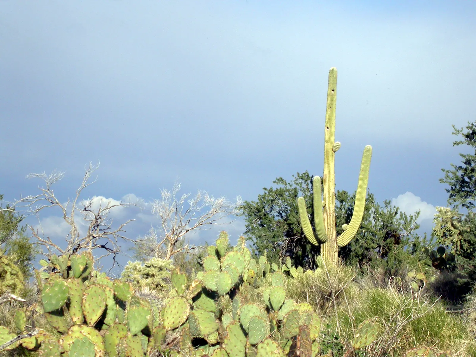
Desert trails in a county preserve in the eastern foothills of the Tucson Mountains.
Area page: Tucson Mountains hikes.
What are the hours at Sweetwater Preserve?
Sweetwater Preserve opens at sunrise and closes at sunset. Day use only, with no overnight camping.
Access
- Rules
Dogs must be on a leash, and you pick up after them. Horses and mountain bikes are allowed. Yield to horses first, then people on foot, then people on bikes. Motorized vehicles, including electric bicycles, are not allowed. Stay on the designated trails. Park only in the designated area.
- Parking
The lot is at 4001 N. Tortolita Road. It is a natural surface lot with room for 40 vehicles and 4 horse rigs. The posted rules say parking is for trail access only.
- Fees
The fee schedule effective July 1, 2023 does not list a day-use fee for this preserve. The county preserve listing and the June 2023 brochure do not list one either.
Lower heat exposure through 5pm (81F forecast at 2pm). Forecast hours start at 1pm. Sunset about 5:26pm. Forecast issued at 11:32am MST.
Check conditions before you go.
Today
Today, hour by hour. Sunset is about 5:26pm, and later hours aren't rated.
Tomorrow morning
Tomorrow from 5am to noon, if the forecast goes that far.
Photos
NWS alerts
No weather alerts for this trail as of the last update.
NWS HeatRisk, experimental
Level 1 (Minor) for 2026-11-12. HeatRisk is an experimental NWS product. For official heat warnings, go by NWS watches, warnings, and advisories.
Trail facts
Trailhead location
Sweetwater Preserve trailhead. 32.27885, -111.08230. The forecast pin is the map point on the county preserve page, at the trailhead on the south end of Tortolita Road. Source: Pima County Sweetwater Preserve.
Elevation
2,469 ft. From USGS elevation data for the map pin.
Forecast area elevation
2,598 ft for the NWS forecast area near Tucson Mountains, AZ. The NWS forecasts for squares about 2.5 km (1.5 miles) across, so it can be hotter or cooler on the trail itself. Forecast updated 11:32am MST.
The preserve
Pima County calls it an 880+ acre preserve in the eastern foothills of the Tucson Mountains, west of Tucson. County crews and volunteers have built 15 miles of trails there. Source: Pima County Sweetwater Preserve.
Brochure distances
The June 2023 brochure lists Desperado Loop at 3.8 miles and Black Rock Loop at 1.6 miles. Saguaro Vista Trail and Red Tail Ridge Trail are 1.2 miles each. Homestead Trail is 1.0 mile. The other named trails on the brochure run from 0.1 mile to 0.9 mile. The brochure does not list elevation gain. Source: Pima County Sweetwater Preserve brochure, June 2023.
Trail system map
The county trail system map lists Desperado Loop at 2.6 miles. That does not match the 3.8 miles in the June 2023 brochure. Black Rock Loop is 1.6 miles on this map too. This map also does not list elevation gain. Source: Pima County Sweetwater Preserve trail system map.
Trailhead elevation
The trailhead map point sits at about 2,469 feet. That is the parking spot, from USGS elevation data, not a high point on the loops. Source: USGS 3DEP elevation point service.
Forecast square
The National Weather Service point for 32.2788, -111.0823 is grid TWC 87,52, near Tucson Mountains, in forecast zone AZZ504. Source: NWS points API.
Who can use the trails
Pima County lists hiking, trail running, horseback riding, and mountain biking. Dogs are allowed on a leash. The county says the trails suit beginner and intermediate riders. Source: Pima County Sweetwater Preserve.
Dogs, horses, and bikes
The June 2023 brochure says dogs must be on a leash and that you pick up after them. Horses and mountain bikes are allowed. Yield to horses first, then people on foot, then people on bikes. Motorized vehicles, including electric bicycles, are not allowed. Stay on the designated trails. Park only in the designated area. Source: Pima County Sweetwater Preserve brochure, June 2023.
Fees
The county fee schedule effective July 1, 2023 lists fees for programs, pools, campgrounds, fields, and ranges. It does not list a day-use fee for this preserve. The county preserve listing and the June 2023 brochure do not list one either. Source: Pima County fee schedule effective July 1, 2023.
Water and sun
The June 2023 brochure says to take plenty of water, and to wear a hat and sunscreen. Source: Pima County Sweetwater Preserve brochure, June 2023.
Sun and shade
The brochure describes palo verde and big saguaros on the hillsides, and it tells you to wear a hat and sunscreen. It does not give hour-by-hour shade. Source: Pima County Sweetwater Preserve brochure, June 2023.
Official links
- Sweetwater Preserve
- Sweetwater Preserve Trailhead
- Posted trailhead rules
- June 2023 brochure
- Trail system map
- Pima County notices and closures
- Fee schedule effective July 1, 2023
- NWS forecast point
- King Canyon
- Brown Mountain
- Yetman Trail
- Wasson Peak
- Signal Hill
Nearby trails
- Yetman Trail (4.4 miles away)
- Brown Mountain (5.3 miles away)
- King Canyon (5.4 miles away)
See also the heat guide, the monsoon guide, and today's conditions on every trail.